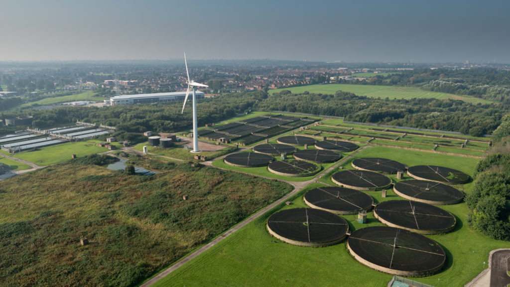
Aerial imaging refers to the practice of taking photographs of the ground and other objects from an elevated point of view, most commonly from aircraft such as airplanes, helicopters, drones or balloons. Though aerial photography first began in the late 19th century, it has evolved significantly over the past century with advances in camera technology, aircraft capabilities and new applications. Today, aerial imaging plays an important role across industries and disciplines ranging from agriculture and insurance to construction, city planning and mapmaking.
Early Developments and Uses in Aerial Photography
Some of the earliest uses of aerial photography included military surveillance, reconnaissance and mapping applications during World War I. Taking photos from hot air balloons and kites, aerial cameras helped provide intelligence on enemy troop movements and terrain features. Shortly after the war, farmers began experimenting with the use of aerial photos to survey and monitor their fields. This allowed for more precise soil analysis and crop planning. In the 1920s, aerial photography became more commercialized with the rise of dedicated aviation companies that offered aerial survey and mapping services to industries. Advances in lighter weight cameras helped expand photography from hot air balloons to fixed wing aircraft as well.
Rise of Aerial Imaging Technologies
Over the following decades, aerial photography evolved significantly with new camera technologies. The development of single lens reflex cameras and color film in the 1950s allowed for more detailed aerial photos. Roll film and single shot cameras were replaced by advanced motorized aerial camera systems. By the 1990s, digital cameras replaced film, vastly improving the speed, quality and data management of aerial images. Today, specialized data capture cameras supporting wavelengths beyond visible light have enabled applications like infrared agriculture monitoring and mapping of underground infrastructure. Drones have further revolutionized the field by making aerial image acquisition more accessible and cost effective for a variety of commercial and civil applications.
Current Applications of Aerial Imaging
Agriculture: Aerial Imaging supports precision agriculture techniques by capturing multispectral images that analyze crop health, soil conditions and detect pests/diseases. Thermal imagery identifies water/moisture stresses. Images help optimize inputs, plan irrigation and improve yields.
Infrastructure Inspection: Regular aerial surveys allow monitoring of linear infrastructure like roads, railways, pipelines and power lines for maintenance needs or damage from natural disasters. 3D models reconstructed from images enable virtual inspections.
Construction Planning and Progress Monitoring: High resolution images captured at different project stages are used to plan earthworks, monitor construction progress and ensure compliance with engineering designs and zoning requirements.
Disaster Management: Following hurricanes, floods and wildfires, aerial surveys help assess damage extent and prioritize relief efforts. Images also support reconstruction planning by documenting pre-disaster infrastructure status.
Urban Planning: Orthorectified aerial images stitched into high resolution maps provide a geographic context to analyze land use patterns, model future developments and study impacts on traffic/utilities. 3D city models get created.
Insurance and Real Estate: Property insurers use aerial imagery to assess risks, verify quotes and process claims speedily post-events. Images listing homes for sale provide buyers virtual tours to shortlist properties.
Environmental Monitoring: Multi-year image datasets help analyze changes to coastlines, measure effects of erosion/pollution, and monitor wildlife/forests. Conservation efforts are informed.
Emerging Technologies in Aerial Imaging
New platforms like vertical take-off and landing drones powered by computer vision are making aerial photography more accessible for a variety of applications. mini/micro drones capture images minutes after tasking, at lower costs than helicopters or planes. Meanwhile, technologies like photogrammetry use structure from motion algorithms to turn multiple overlapping images into high fidelity 3D models and dense point clouds. AI/computer vision driven analytics of image datasets are automating tasks like infrastructure inspection and agriculture monitoring which were earlier done manually. Hyperspectral cameras capturing across 100s of spectral bands add new dimensions to material analysis from aerial views. These emerging trends promise to further transform industries through advanced applications of aerial imaging.
*Note:
1. Source: Coherent Market Insights, Public sources, Desk research
2. We have leveraged AI tools to mine information and compile it


